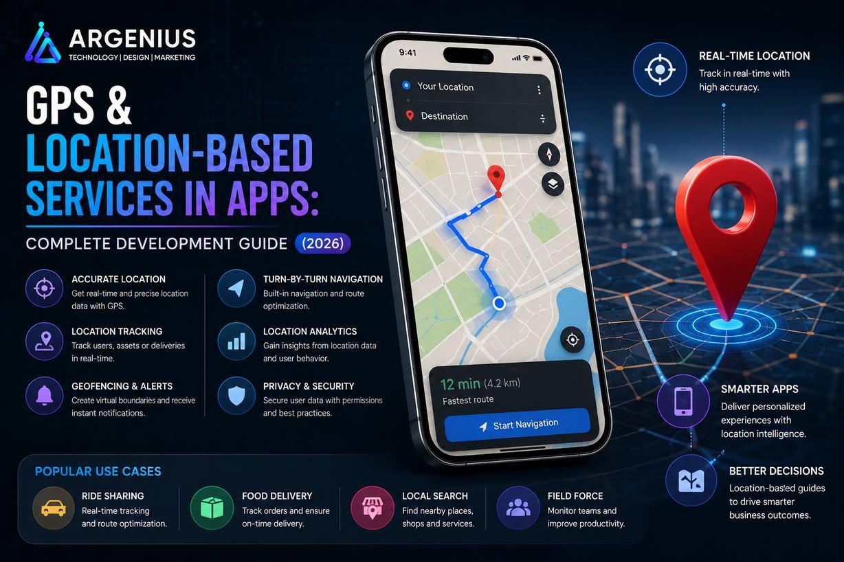
GPS and Location-Based Services (LBS) power modern mobile applications by enabling real-time tracking, navigation, nearby search, geofencing, delivery tracking, ride-hailing, and personalized experiences. This complete guide covers GPS app development, Google Maps integration, technologies, APIs, costs, security, and future trends.
Location has become one of the most valuable pieces of information in today's digital world. From booking a cab and ordering food to finding nearby hospitals or tracking a delivery, almost every modern mobile application relies on GPS and Location-Based Services (LBS). These technologies help businesses deliver personalized experiences, optimize operations, and provide real-time services based on a user's geographical location.
GPS (Global Positioning System) allows mobile devices to determine their precise position using satellite signals, while Location-Based Services combine GPS with technologies like Wi-Fi, Bluetooth, mobile networks, and digital maps to deliver accurate location-aware features. Together, they power navigation, live tracking, route optimization, geofencing, proximity marketing, emergency assistance, and much more.
For businesses, integrating GPS into a mobile app is no longer just an additional feature—it's often a core requirement. Industries such as transportation, logistics, healthcare, travel, fitness, eCommerce, food delivery, real estate, and social networking use location services to improve customer experience and operational efficiency.
However, implementing GPS requires careful planning. Developers must consider battery optimization, location accuracy, privacy regulations, permissions, offline functionality, and secure data handling to create reliable and user-friendly applications.
In this comprehensive guide, you'll learn everything about GPS & Location-Based Services in Apps, including how GPS works, popular use cases, Google Maps integration, geofencing, technology stack, APIs, security considerations, development costs, and future trends.
At Argenius, we build intelligent mobile applications with advanced GPS and mapping capabilities that help businesses deliver real-time, location-aware experiences across Android, iOS, and web platforms.
What are GPS & Location-Based Services (LBS)?
GPS (Global Positioning System) is a satellite-based navigation system that enables devices to determine their geographic location anywhere in the world. Location-Based Services (LBS) use GPS data along with maps, Wi-Fi, cellular networks, and Bluetooth to provide services based on a user's current location.
These services enable applications to:
- Detect User Location
- Provide Turn-by-Turn Navigation
- Track Vehicles
- Find Nearby Businesses
- Monitor Deliveries
- Create Geofences
- Share Live Location
- Optimize Routes
- Send Location-Based Notifications
- Analyze Travel Patterns
Rather than simply displaying a map, modern LBS platforms combine multiple technologies to deliver accurate, real-time, and context-aware experiences.
Why GPS Integration is Important
Businesses across industries benefit from integrating location services into their applications.
Key advantages include:
- Real-Time Tracking
- Better Customer Experience
- Faster Deliveries
- Route Optimization
- Improved Fleet Management
- Personalized Services
- Location-Based Marketing
- Enhanced Safety
- Operational Efficiency
- Better Business Analytics
GPS-powered applications improve decision-making while creating more convenient user experiences.
How GPS Works
A typical GPS workflow involves several technologies working together.
The process includes:
- The mobile device receives signals from GPS satellites.
- The operating system calculates the device's coordinates.
- The application requests location permission.
- The location is displayed using mapping services.
- The backend processes location data when required.
- Real-time updates are delivered to users or administrators.
For improved accuracy, devices may also use Wi-Fi positioning, Bluetooth beacons, and cellular networks when GPS signals are weak.
Types of Location Services
Different applications use different location techniques depending on business requirements.
Real-Time GPS Tracking
Continuously updates a user's location.
Examples:
- Taxi Booking
- Food Delivery
- Fleet Tracking
- Employee Monitoring
Navigation Services
Provides route guidance and estimated arrival times.
Examples:
- Google Maps
- Ride-Hailing Apps
- Travel Applications
Geofencing
Creates virtual geographic boundaries that trigger actions when users enter or leave a specified area.
Common use cases:
- Retail Offers
- Attendance Systems
- Delivery Alerts
- Security Zones
Nearby Search
Helps users discover nearby places and services.
Examples:
- Restaurants
- Hospitals
- Hotels
- Petrol Pumps
- ATMs
Live Location Sharing
Allows users to securely share their current location.
Common use cases:
- Family Tracking
- Emergency Services
- Social Networking
- Logistics
Route Optimization
Calculates the fastest or most efficient route.
Used in:
- Logistics
- Delivery Apps
- Fleet Management
- Travel Planning
Business Models Using GPS
Location-based services are valuable across many industries.
Popular use cases include:
- Taxi Booking Apps
- Food Delivery Apps
- Logistics & Courier Apps
- Travel Applications
- Fitness Apps
- Healthcare Apps
- Emergency Services
- Real Estate Apps
- eCommerce Delivery Apps
- Ride Sharing Platforms
- Social Networking Apps
- Fleet Management Systems
Essential User Features
A modern GPS-enabled application should provide:
- Live Location Tracking
- Interactive Maps
- Route Navigation
- Nearby Search
- Distance Calculation
- ETA (Estimated Time of Arrival)
- Favorite Locations
- Live Location Sharing
- Offline Maps
- Location History
Admin Features
Businesses require advanced monitoring and analytics capabilities.
Important admin features include:
- Fleet Dashboard
- Driver Tracking
- Customer Tracking
- Route Analytics
- Geofence Management
- Heat Maps
- Reports & Analytics
- Notification Management
- Device Monitoring
- Activity Logs
Recommended Technology Stack
Mobile Development
- Flutter
- React Native
- Kotlin
- Swift
Backend
- Laravel
- Node.js
- Spring Boot
- Django
Maps & Location APIs
- Google Maps SDK
- Google Places API
- Google Directions API
- Google Geocoding API
- Mapbox
- OpenStreetMap
Database
- PostgreSQL + PostGIS
- MySQL
- MongoDB
Cloud
- AWS
- Google Cloud
- Microsoft Azure
Real-Time Communication
- WebSockets
- Firebase Realtime Database
- Socket.IO
A scalable technology stack ensures accurate location tracking, fast performance, and reliable user experiences.
GPS App Development Process
Building a GPS-enabled mobile application requires more than simply displaying a map. It involves accurate location tracking, route calculation, real-time communication, secure data management, battery optimization, and privacy compliance.
1. Requirement Analysis
The development process begins with understanding business goals and defining how location data will be used.
This phase includes:
- Business Requirements
- User Journey Planning
- GPS Accuracy Requirements
- Real-Time Tracking Needs
- Geofencing Requirements
- Privacy & Compliance Planning
- API Selection
2. UI/UX Design
A location-based application should provide an intuitive interface that makes navigation and tracking simple.
Key design components include:
- Interactive Maps
- Route Visualization
- Live Tracking Screen
- Search Bar
- Nearby Places
- ETA Display
- Geofence Alerts
- Location Sharing
3. Backend Development
The backend manages all location data, route calculations, notifications, analytics, and APIs.
Core backend modules include:
- User Authentication
- Location Storage
- Route Management
- Driver/Vehicle Tracking
- Geofence Engine
- Notification System
- Analytics Dashboard
- Reports & Logs
4. GPS & Maps Integration
Integrate mapping and GPS services to enable real-time navigation and location features.
Popular integrations include:
- Google Maps SDK
- Google Places API
- Google Directions API
- Google Geocoding API
- Mapbox SDK
- OpenStreetMap APIs
5. Real-Time Communication
For applications like taxi booking and delivery tracking, live updates are essential.
Technologies commonly used:
- WebSockets
- Firebase Realtime Database
- Socket.IO
- MQTT
6. Testing & Quality Assurance
GPS features must be tested in different environments and network conditions.
Testing includes:
- GPS Accuracy Testing
- Route Calculation
- Geofence Triggers
- Offline Mode
- Battery Usage
- API Performance
- Cross-Device Compatibility
- Stress Testing
7. Deployment
Once testing is complete, deploy the application to production.
Deployment includes:
- Google Play Store
- Apple App Store
- Cloud Server Configuration
- Monitoring Tools
- API Security
- Backup & Recovery
8. Maintenance & Updates
Continuous improvements keep the GPS system reliable and secure.
Post-launch support includes:
- Bug Fixes
- API Updates
- Map Data Updates
- Performance Optimization
- Security Improvements
- Feature Enhancements
Google Maps API Integration
Google Maps provides one of the most comprehensive mapping platforms for mobile applications.
Common APIs include:
Google Maps SDK
Displays interactive maps inside the application.
Places API
Searches nearby locations such as:
- Restaurants
- Hospitals
- Hotels
- Petrol Pumps
- ATMs
Directions API
Provides:
- Route Planning
- Distance Calculation
- Estimated Travel Time
- Alternative Routes
Geocoding API
Converts:
- Address → Coordinates
- Coordinates → Address
Geofencing Implementation
Geofencing creates virtual geographic boundaries around specific locations.
When users enter or leave a predefined area, the application can automatically trigger actions.
Popular use cases include:
- Attendance Systems
- Retail Promotions
- Delivery Notifications
- Fleet Management
- Smart Home Automation
- Security Alerts
Geofencing improves automation while enabling context-aware user experiences.
Real-Time Tracking Architecture
A scalable tracking system generally follows this architecture:
- User grants location permission.
- Device collects GPS coordinates.
- Coordinates are securely sent to the backend.
- Backend stores and processes location updates.
- WebSockets or Firebase broadcast live updates.
- Admin dashboard displays current locations.
- Notifications are triggered when predefined conditions are met.
This architecture enables smooth and reliable real-time tracking.
GPS App Development Cost (₹ INR)
Development cost depends on tracking complexity, mapping services, APIs, and real-time infrastructure.
| Application Type |
Estimated Cost |
| Basic GPS Integration |
₹1,00,000 – ₹3,00,000 |
| Live Tracking Mobile App |
₹3,00,000 – ₹8,00,000 |
| Logistics/Fleet Management System |
₹8,00,000 – ₹20,00,000 |
| Enterprise GPS Platform |
₹20,00,000+ (Custom Pricing) |
Factors Affecting Cost
Pricing depends on:
- Android & iOS Support
- Google Maps API Usage
- Real-Time Tracking
- Geofencing
- Route Optimization
- Cloud Infrastructure
- Offline Maps
- Analytics Dashboard
- Third-Party Integrations
- Long-Term Maintenance
Essential API Integrations
Modern GPS-enabled applications rely on multiple APIs.
Maps
- Google Maps SDK
- Mapbox SDK
- OpenStreetMap
Navigation
- Google Directions API
- Distance Matrix API
Location Search
Authentication
- Firebase Authentication
- OAuth 2.0
Notifications
- Firebase Cloud Messaging
- OneSignal
Analytics
- Firebase Analytics
- Google Analytics
Cloud Storage
- AWS S3
- Google Cloud Storage
Security & Privacy Best Practices
Location data is highly sensitive and should always be protected.
Recommended practices include:
- Request Location Permission Transparently
- Use HTTPS for Data Transmission
- Encrypt Stored Location Data
- Implement Role-Based Access Control
- Minimize Location Data Collection
- Provide User Privacy Controls
- Support Location Permission Revocation
- Regular Security Audits
- Secure API Authentication
- Follow GDPR and Regional Privacy Regulations
Protecting user privacy helps build trust and ensures regulatory compliance.
Battery Optimization
Continuous GPS tracking can consume significant battery power.
Best practices include:
- Use Balanced Location Accuracy
- Reduce Background Updates
- Trigger Location Updates Based on Events
- Batch Location Requests
- Stop Tracking When Not Needed
- Optimize GPS Polling Frequency
Efficient battery management improves user satisfaction and app performance.
Common Challenges
Developers often face several challenges when building GPS-enabled applications.
Common issues include:
- Poor GPS Accuracy Indoors
- High Battery Consumption
- Weak Network Connectivity
- Delayed Location Updates
- API Rate Limits
- Privacy Regulations
- Device Compatibility
- Offline Navigation
- Real-Time Synchronization
- High Server Load During Peak Traffic
Planning for these challenges early results in a more reliable application.
Google Maps vs Mapbox
| Feature |
Google Maps |
Mapbox |
| Global Coverage |
✅ Excellent |
✅ Excellent |
| Navigation APIs |
✅ Advanced |
✅ Advanced |
| Custom Map Styling |
Limited |
✅ Extensive |
| Offline Maps |
Limited |
✅ Strong |
| Developer Flexibility |
High |
Very High |
| Pricing |
Pay-as-you-go |
Flexible Plans |
| Best For |
General Mobile Apps |
Highly Customized Mapping Apps |
Google Maps is ideal for most business applications, while Mapbox is preferred for projects requiring extensive map customization and offline capabilities.
Benefits of GPS & Location-Based Services
GPS integration provides significant advantages across industries.
Key benefits include:
- Real-Time Tracking
- Improved Customer Experience
- Faster Deliveries
- Better Route Optimization
- Reduced Operational Costs
- Increased Safety
- Personalized User Experiences
- Better Fleet Management
- Data-Driven Decision Making
- Competitive Business Advantage
These benefits make location services a valuable investment for modern mobile applications.
Future Trends
Location technology continues to evolve with advancements in AI and connected devices.
Key trends include:
- AI-Powered Route Optimization
- Indoor Positioning Systems (IPS)
- Augmented Reality Navigation
- Autonomous Vehicle Integration
- Smart City Infrastructure
- IoT-Based Asset Tracking
- Drone Delivery Tracking
- Predictive Traffic Analytics
- Hyper-Local Personalization
- 5G-Enabled Real-Time Tracking
Businesses adopting these technologies can deliver faster, smarter, and more personalized location-based experiences.
Why Businesses Choose Argenius
At Argenius, we develop secure, scalable, and high-performance GPS-enabled mobile applications tailored to business needs.
Our expertise includes:
- GPS App Development
- Google Maps Integration
- Mapbox Integration
- Live Location Tracking
- Geofencing Solutions
- Fleet Management Systems
- Delivery Tracking Apps
- Flutter & React Native Development
- Backend API Development
- Cloud Infrastructure & Long-Term Support
Whether you're building a taxi booking platform, logistics solution, travel application, healthcare service, or delivery app, Argenius delivers reliable GPS solutions designed for performance, scalability, and security.
Final Thoughts
GPS and Location-Based Services have become essential components of modern mobile applications. From real-time tracking and navigation to geofencing and personalized experiences, location technology enables businesses to deliver smarter, faster, and more efficient services.
Building a successful GPS-enabled application requires accurate mapping, secure location handling, optimized battery usage, scalable backend architecture, and compliance with privacy regulations. By selecting the right technologies and implementation strategies, businesses can create location-aware applications that improve customer satisfaction and operational efficiency.
If you're planning to build a GPS-enabled mobile application with advanced mapping and tracking capabilities, Argenius can help you design and develop a secure, scalable, and future-ready solution.
Frequently Asked Questions
What are Location-Based Services (LBS)?
Location-Based Services (LBS) use GPS, Wi-Fi, cellular networks, and mapping technologies to provide services based on a user's geographic location, such as navigation, nearby search, live tracking, and geofencing.
Which map service is best for mobile apps?
Google Maps is the preferred choice for most business applications because of its global coverage, navigation features, and comprehensive APIs. Mapbox is ideal for projects requiring advanced customization and strong offline map support.
How much does GPS app development cost?
Basic GPS integration generally costs ₹1 lakh–₹3 lakh, while advanced real-time tracking and logistics solutions typically range from ₹8 lakh–₹20 lakh or more, depending on complexity and infrastructure requirements.
What is geofencing?
Geofencing creates virtual geographic boundaries around a specific area. When users enter or leave that area, the application can automatically trigger notifications, actions, or workflows.
How can GPS tracking affect battery life?
Continuous location tracking consumes battery power. Using balanced location accuracy, event-based updates, and optimized polling intervals helps reduce battery usage while maintaining reliable tracking.
Which industries benefit from GPS integration?
GPS is widely used in taxi booking, logistics, food delivery, travel, healthcare, fitness, eCommerce, fleet management, emergency services, and real estate applications.
Can Argenius develop custom GPS-enabled mobile applications?
Yes. Argenius provides end-to-end GPS app development services, including Google Maps integration, Mapbox integration, real-time tracking, geofencing, route optimization, backend APIs, cloud deployment, and ongoing maintenance.